Home / Destinations / Damaraland

Damaraland

Plan the exact heritage site, conservancy, guide, road, and route—not an undefined promise of remote wilderness.

Start with the map label

Damaraland is a region to define, not one attraction

Travel itineraries use “Damaraland” for a broad part of northwestern Namibia. It is not one national park, one community, or one road. Towns, homes, working communal land, conservancies, farms, concessions, heritage places, and wildlife corridors sit within the wider area, each with its own access and visitor context.

For practical planning, name the place you actually mean: Twyfelfontein or /Ui-//aes, the Brandberg area, Uis, Khorixas, a named conservancy, a specific lodge, or a permitted route toward Palmwag and Kunene. That turns a vague map label into decisions about guides, roads, community relationships, and time.

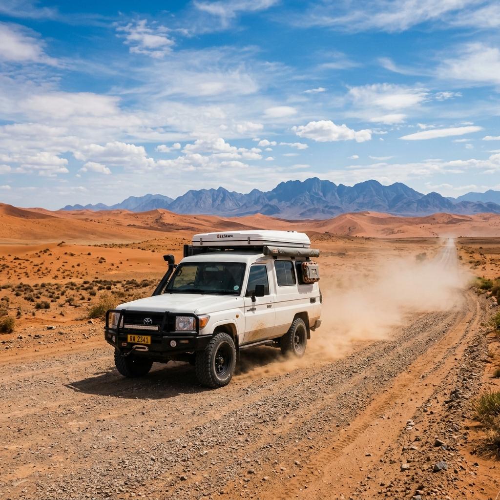
Image note: The hero is an existing generic route-planning illustration of arid gravel-road travel. It does not document a named Damaraland site or current road condition.

Choose the reason to stop

Four distinct Damaraland experiences

One short stay rarely does all four well. Choose a primary focus, then make any additional stop serve the same route rather than creating a detour.

Managed World Heritage site

Twyfelfontein or /Ui-//aes

Choose this focus for rock engravings, paintings, and interpretation of the site’s relationship with long-term hunter-gatherer practices. Follow the visitor route and current site instructions rather than treating the panels as an open-air photo backdrop.

Heritage walk and mountain setting

Brandberg area

Use Uis or another confirmed base for a separately planned heritage walk. Ask the site or operator about guide arrangements, walking conditions, water, heat, heritage rules, and the meeting point before setting out.

Guided, uncertain encounter

Desert-adapted wildlife

Elephants and other wildlife move through a large, open system rather than a scheduled viewing circuit. Choose an experienced local guide, keep expectations flexible, and accept that no sighting may be the responsible outcome.

A governance and benefit question

Conservancy-based stay

A conservancy is not a generic eco-label. Identify the named conservancy, ask how the lodge or guide works with it, and look for specific information about jobs, fees, local decision-making, and conservation responsibilities.

Heritage before checklist

Plan Twyfelfontein as an interpreted heritage visit

UNESCO lists Twyfelfontein or /Ui-//aes for its rock engravings and paintings and the record they provide of hunter-gatherer ritual and economic practices over a long period. The useful travel response is to protect the site and make room for interpretation—not to rush through a panel checklist.

  1. 01

    Confirm the exact site plan

    Check the current arrival point, visitor procedure, guide arrangement, walking expectations, payment method, and any temporary restriction. Do not rely on an old timetable or tour description.

  2. 02

    Allow time for interpretation

    The meaning of the visit is in the landscape, engravings, paintings, and the guide’s explanation—not in collecting a single famous panel. Choose a route suited to your mobility and the day’s conditions.

  3. 03

    Protect the physical record

    Stay on the managed route, do not touch or trace rock surfaces, and keep bags, tripods, and hands away from panels. Follow photography instructions and never move stones or objects for a composition.

  4. 04

    Keep the onward drive realistic

    Do not pair the heritage visit with a rigid arrival at a distant lodge. Heat, walking pace, road conditions, and the quality of the interpretation deserve margin.

Treat Brandberg as its own access decision

Namibia’s National Heritage Council records the Brandberg Area among the country’s heritage places, while the Namibia Tourism Board lists a visitor contact near Uis. Use those channels to verify the current heritage walk instead of transferring Twyfelfontein assumptions to a different site.

Check the heritage register

Heritage walk

Arrange the walk through the current heritage-site or locally registered visitor channel. Confirm whether a guide is required, which route is offered, and whether the terrain matches everyone in the group.

Mountain activity

A short heritage walk and a serious mountain outing are not interchangeable. For any longer hike, ask about route authorization, guide competence, heat, water, communications, overnight arrangements, and evacuation planning.

Uis as a base

Uis can be a practical service and accommodation point for the Brandberg area, but opening hours, fuel, food, and guide availability should be reconfirmed rather than assumed from the town name alone.

No sighting guarantee

Responsible desert-adapted wildlife planning

“Desert-adapted” describes wildlife living and moving through Namibia’s arid west; it does not make an encounter predictable. MEFT reporting and NACSO’s northwestern monitoring confirm an active conservation landscape, while the day’s animal movements remain uncertain.

A guide should improve interpretation, access decisions, and restraint. Before booking, ask what happens when the animals are absent or when continuing the search would cause disturbance.

  • Book a guide for current local knowledge, legal access, wildlife interpretation, and lower-impact positioning—not for a guaranteed elephant or rhino sighting.
  • Ask which named conservancy, concession, or landholder authorizes the route and whether the operator may leave public roads or use dry-river tracks.
  • Never feed wildlife, call it closer, block its direction of travel, crowd another vehicle, or leave the vehicle unless the guide confirms it is permitted and appropriate.
  • If an animal changes direction, bunches up, watches the vehicle closely, or a guide asks the group to withdraw, give it more space without negotiating for one more photograph.
  • Avoid sharing precise live locations for sensitive wildlife. Follow the guide or conservation authority’s instructions about photography and location data.
  • Treat a no-sighting day as part of wildlife travel. Long searching drives can increase disturbance, fatigue, fuel use, and pressure on the guide to take shortcuts.

Verify the relationship

How to assess a conservancy stay or guide

NACSO explains that communal conservancies are self-governing institutions through which communities exercise rights and responsibilities over natural resources and can establish tourism enterprises. That framework does not prove that every tourism product produces the same benefits.

Ask for the named relationship and current evidence. A credible answer can describe who holds the agreement, who makes decisions, what the operator pays or provides, and how concerns are handled.

Who holds the agreement?

Ask for the name of the conservancy or community institution and the nature of its agreement with the lodge, campsite, guide, or concession operator.

What benefit is specific and current?

Look for concrete, date-relevant information about employment, guide fees, lease or concession payments, procurement, training, or community-directed projects.

Who decides the visitor experience?

For a community or cultural visit, ask who designed it, who can decline photography, how participants are paid, and whether the format reflects current community choices.

What does the rate exclude?

Confirm conservancy or concession fees, guide charges, transfers, park or heritage entry, meals, activities, and cancellation terms without relying on a broad “community tourism” label.

Conditions over averages

Road and season planning

There is no single Damaraland road condition or universally suitable vehicle. Work from the exact route, recent weather, rental terms, and the latest property instructions.

Match the vehicle to the exact access road

A main regional road, a maintained lodge approach, and a riverbed or concession track are different driving propositions. Ask the property or operator for the final approach, then confirm that it is allowed by the rental agreement.

Plan for heat, cold nights, dust, and rain

Namibia Tourism Board identifies summer as the rainy season and notes large temperature changes by season and location. Pack for the actual month, while keeping extra water and a road contingency in every season.

Treat river crossings as condition-dependent

Rain can alter surfaces, crossings, and access quickly. Never enter water-covered road sections without reliable local guidance, and check Roads Authority notices plus the latest information from the next accommodation.

Navigate to a named place, not “Damaraland”

Save the property coordinates, access instructions, backup route, fuel plan, and contact details offline. Regional labels are too broad for estimating the last part of the drive.

Place it between real stops

Damaraland route pairings

Use a route pairing to expose the trade-off. A coast-to-Etosha link is different from a remote Kunene or Skeleton Coast extension, even when a brochure calls all of them Damaraland.

The classic northbound connection

Central coast → Damaraland → Etosha

Use one Damaraland base for a clear priority—heritage, landscape, or a guided wildlife activity—before continuing toward the Etosha gate that matches your accommodation.

A granite-landscape stop before the deeper northwest

Coast → Spitzkoppe → Uis / Brandberg

Spitzkoppe can work as a separate day visit or camping night before Uis and Brandberg. Keep its entry, walking, camping, and heat plan distinct from Brandberg and Twyfelfontein access.

A deliberate remote-northwest replacement route

Damaraland → Opuwo → Epupa Falls

Extend north only after checking fuel, road condition, communications, concession or conservancy access, and the exact lodge position. Epupa Falls needs its own overland time and should not be treated as a quick Damaraland detour. Cultural visits require the same consent and benefit questions as elsewhere.

Public-road visit or specialist extension

Damaraland → Skeleton Coast edge

Decide whether you mean a public-road coastal connection, a permitted route, or a remote lodge product. Those options reach different places and require different vehicles, support, and budgets.

Questions worth settling before you go

Is Damaraland a national park?

No. Travel businesses use the name for a broad region containing many forms of land tenure and management. Verify the exact heritage place, public road, conservancy, concession, lodge, or activity area.

Do I need a 4x4?

Not for every itinerary sold under the Damaraland label. The deciding factors are the current route, final lodge approach, planned track, rental terms, weather, clearance, tyres, and driver experience. Ask the provider for the exact access instructions.

Will I see desert-adapted elephants?

Possibly, but never reliably. The animals range through a large landscape and their movements vary. Choose a responsible local guide for interpretation and current conditions, while booking a trip you would still value without a sighting.

Can I visit Twyfelfontein and Brandberg in one day?

A map may make the combination look possible, but they are separate heritage experiences with their own access, guide, walking, heat, and onward-drive needs. Confirm the current logistics before choosing, and prioritize one when the day would otherwise become rushed.

What is the best season?

There is no single answer for heritage walking, road conditions, wildlife hopes, heat tolerance, and budget. Compare the expected climate with your exact activities, then reconfirm roads and access close to travel.

Planning essentials

Fit Damaraland into a route without flattening the region

Choose a named base and one primary reason to stop, then verify the access and relationships around it. These decisions are more useful than trying to complete a generic Damaraland checklist.

Useful route position

Between the coast and Etosha

This is the simplest pairing for many first trips. The right Etosha gate and Damaraland base depend on the exact accommodation, not the region name.

Stay structure

One focused base—or two distinct ones

Use one base for a single priority. Add a second only when Brandberg, Twyfelfontein, or a remote conservancy stay each has enough time to justify the transfer.

Booking priority

Access, guide, and benefit model

Settle the final road, authorized activity area, guide arrangement, conservancy relationship, and inclusions before comparing room style.

Ways to structure the stay

OptionBest for
Uis / Brandberg-area baseA Brandberg heritage walk, a town-based resupply point, or a southern approach from the central coast.
Khorixas / Twyfelfontein-area baseTwyfelfontein and nearby heritage or landscape stops without adding a remote lodge transfer.
Conservancy or concession lodgeGuided nature activities, a slower stay, and travelers willing to research the exact community and access relationship.

Before you book

  • Save the exact accommodation coordinates, final road instructions, contact number, and backup arrival plan offline.
  • Ask whether the final access requires high clearance, four-wheel drive, a lodge transfer, or a driver with sand or riverbed experience.
  • Confirm fuel opportunities, meal arrangements, drinking-water advice, dietary needs, tyre support, and payment options with the next stay.
  • For Twyfelfontein or Brandberg, verify the current visitor procedure, guide arrangement, walking conditions, and photography rules.
  • For wildlife tracking, identify the guide, authorized area, named conservancy or concession, group size, vehicle, and cancellation policy.
  • For any cultural visit, ask who designed it, how consent works, where the fee goes, and whether participants can decline photographs.
  • Check Roads Authority notices and ask the accommodation about recent rain, damaged approaches, crossings, and realistic arrival margins.

Turn the region name into a real route

Start with the coast and Etosha dates, add a named Damaraland base, then confirm the guide, road, fuel, food, and arrival margin around it.

Open Route Planner