Home / Namibia Beaches

Namibia Beaches & Coast Guide

Choose the right coast base, understand the cold Atlantic, and separate a scenic shoreline day from a safe swimming plan.

Set expectations first

A coast trip, not a conventional tropical beach break

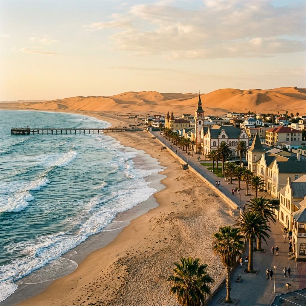
Namibia's Atlantic shore is where dunes, fog, wetlands, working harbours, rocky coves, and protected desert meet the sea. It rewards walking, birding, photography, marine excursions, and slow route days. Swimming can be possible in a locally designated area, but it should be a conditions-led decision rather than the premise of the trip.

The cold Benguela upwelling shapes that experience. Pack a warm layer even when the inland forecast is hot, and avoid choosing a base from a generic “best beach” list. Swakopmund, Walvis Bay, the northern protected coast, and Lüderitz solve different travel problems.

Choose your base

Four different coast experiences

Start with the activity and route you want, then choose the shoreline—not the other way around.

Town beach + easy base

Swakopmund

Choose Swakopmund for walkable seafront time, cafés, museums, tour offices, and a practical rest stop. The Mole is the clearest place to ask locally about bathing, but signs and lifeguard instructions decide whether entering the sea is appropriate that day.

Open the Swakopmund guide

Wetlands + marine activities

Walvis Bay

Choose Walvis Bay for the lagoon, waterbirds, Pelican Point departures, and access to permitted Sandwich Harbour trips. Treat it as a wetland and activity base rather than assuming every stretch of shoreline is a swimming beach.

Open the Walvis Bay guide

Scenery + protected landscapes

Northern coast

North of Swakopmund, Dorob National Park, Cape Cross, and the Skeleton Coast shift the focus toward coastal landscapes, wildlife, angling areas, and remote logistics. Public roads, permits, camping rules, and closed zones vary by location.

Plan the Skeleton Coast

Rocky coves + southern route

Lüderitz

Lüderitz offers a cool, often windy and fog-prone Atlantic setting, a sheltered bay, and scenic peninsula drives. It belongs in a longer southern itinerary; nearby Tsau //Khaeb has restricted access beyond the public town and road network.

Open the Lüderitz guide

Swimming decision

Before entering the Atlantic

Conditions at the exact place and time matter more than the town name or season.

Expect cool water

The Benguela system brings cool, nutrient-rich water to the coast through upwelling. Air can feel pleasant while the sea still feels cold, and conditions vary too much for one dependable temperature figure.

Look for active supervision

Use a designated bathing area only when it is open, follow posted restrictions, and ask the lifeguard about the day’s conditions. A calm-looking surface is not evidence that the water is safe.

Treat open surf differently

Breaking waves can create rip currents and strong shorebreak. Never enter alone, keep children within reach, stay away from rocks and jetties, and choose a shore-side visit when supervision or local condition information is absent.

The safe answer can be “stay out today”

Swakopmund's municipal rules allow lifeguards or authorised officials to restrict bathing when the sea is unsafe. Obey markers, flags, and instructions. Elsewhere, the absence of a warning sign or lifeguard is not an assurance of safe water.

Read the shoreline

Match the place to the plan

“Beach” can describe four very different environments along this coast.

Shore typeExamplesGood fitVerify locally
Supervised town bathing areaThe Mole area in Swakopmund when operating conditions allowA possible short swim or family beach stopLifeguard presence, signs, flags, tide, and any temporary closure
Town seafront or open-ocean beachSwakopmund shoreline and exposed beaches outside sheltered areasWalking, photography, sunset, and watching the surfAccess, shorebreak, wind, fog, currents, and personal security
Lagoon, bay, or wetland edgeWalvis Bay lagoon and Lüderitz bay environmentsBirding, promenades, boating, kayaking, or guided water sportsDesignated use, wildlife buffers, operator rules, harbour activity, and water conditions
Protected or remote coastDorob, Sandwich Harbour, Skeleton Coast, and Tsau //Khaeb areasScenic drives, wildlife, angling where permitted, and guided accessPark boundary, permit, authorised road, vehicle suitability, tides, and recovery plan

Active coast

Surf and water-activity checks

Advertising describes the opportunity. A qualified local assessment determines whether the day suits you.

Surfing and bodyboarding

Ask a reputable local surf provider about the exact break, tide, swell, current, water temperature, board, wetsuit, and your ability level. Do not infer safe conditions from other surfers already being in the water.

Kitesurfing and windsurfing

Walvis Bay and Lüderitz are promoted for wind sports, but strong wind is a hazard as well as the attraction. Beginners should use instruction and a site selected for their level; experienced riders still need local launch and exclusion-zone guidance.

Kayaks, cruises, and boats

Compare operator licensing, flotation equipment, weather limits, wildlife-interaction policy, group size, and cancellation terms. Sightings and routes are conditional, and a changed or cancelled trip can be the responsible outcome.

Protected coast

Access is part of conservation

Town beaches can sit close to national parks, wetlands, seal habitat, bird nesting areas, and restricted diamond land. Verify the precise boundary and route before turning from a public road.

  • Stay on authorised roads and tracks; vehicle marks can damage sensitive gravel plains, lichen fields, dunes, and nesting habitat.
  • Do not treat an empty beach as unrestricted. Check the park, reserve, concession, municipal, or diamond-area boundary before leaving a public road.
  • Secure the required permit before visiting Sandwich Harbour, and use an authorised operator where concession rules require one; a 4x4 alone does not create access rights.
  • Give seals and coastal birds space, keep food secured, and never position yourself between wildlife and the sea.
  • Leave shells, plants, stones, archaeological material, and shipwreck remains where they are, and carry all waste out.

Route fit

Build the coast into the journey

A coast stay works best as a route decision, with a buffer for conditions rather than a list of guaranteed activities.

Classic central-coast pause

Sossusvlei → Walvis Bay / Swakopmund → Damaraland or Etosha

Choose one weather-dependent activity, one shore-side day, and enough slack for fog, wind, laundry, or a vehicle check.

Open the 14-day itinerary

Southern coast extension

Fish River Canyon → Lüderitz → Sossusvlei → central coast

This adds a second, very different coast base and long overland stages. Confirm protected-area access separately from ordinary town and peninsula roads.

Open the 21-day itinerary

Northern coast extension

Swakopmund → Dorob / Cape Cross → Skeleton Coast edge or Damaraland

Decide whether you want a public-road day trip, an authorised guided route, or a remote lodge. Those products reach different parts of the coast.

Compare access options